Cookies helfen uns bei der Bereitstellung unserer Dienste. Durch die Nutzung unserer Dienste erklärst du dich mit dem Einsatz von Cookies einverstanden. Mehr Infos OK

Kanada - Webcams
 Anzahl Webcams:
Webcams Kanada
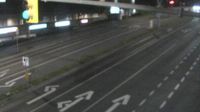
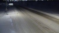
Saanich › Osten: Highway 17 (Blanshard Street) southbound at - Road, looking east
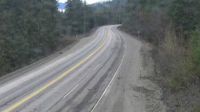
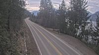
Salmon Arm › Osten: Highway 1 about 8 km southwest of Sicamous at Annis Pit, looking east
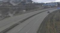
Dufferin 10 › Westen: Highway 1 about 9 km west of Kamloops, looking west
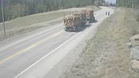
Moyie › Norden: Highway 3 near the south end of - Lake, looking north
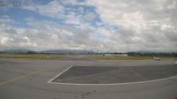
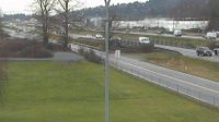
Pitt Meadows › Norden
Central Saanich › Westen: Highway 17 at Mount Newton Cross Road, looking west
Huntsville › Norden: Highway 11 at Highway 141, Looking North
Seguin Township: Highway 400 at Highway 518, Looking Down
Dawson Creek › Osten: Highway 97 at Dangerous Goods Route, west of - looking east
Regional Central Kootenay › Süden: Highway 3A about 1.6 km south of Sanca Creek Bridge, looking south
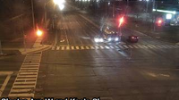
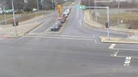
Toronto: Keele St / Steeles Av W
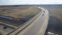
Transportation and utility corridor: Hwy 216: Anthony Henday Drive and 91 Street Overpass
Gitaus › Norden: Highway 16 near Chimdemash Creek about 22 km east of Highway 16 and Highway 37 junction in Terrace, looking north
Grimshaw: Hwy 2: North of Twp Road 834 near
Central Saanich › Norden: Highway 17 at Mount Newton Cross Road, looking north
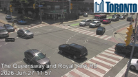
Toronto › Südosten: Royal York Road & The Queensway
Abbotsford › Westen: Highway 1 at Cole Road Rest Area, looking west
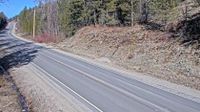
Area E › Norden: Highway 33 about 14 km north of Westbridge and 20 km south of Beaverdell, looking north
Webcam Angebote windy.com.