Cookies helfen uns bei der Bereitstellung unserer Dienste. Durch die Nutzung unserer Dienste erklärst du dich mit dem Einsatz von Cookies einverstanden. Mehr Infos OK

Kanada - Webcams
 Anzahl Webcams:
Webcams Kanada
Area H › Osten: Highway 19 at Horne Lake Road, looking east
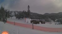
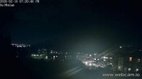
Saint-David-de-Falardeau › Südosten: Le valinouet centre de ski

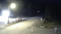
Weyburn › Nordwesten: true
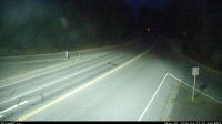
Area E › Nordwesten: Highway 3 at Highway 33 junction in Rock Creek, looking northwest
Campbell River › Süden: Highway 19 about 2.5 km south of - at Willis Road, looking south
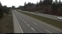
Area G › Osten: Highway 19 south of Qualicum Interchange at Highway 4, looking east
Kamloops › Westen: Highway 1 at Peterson Creek bridge in - looking west
Area A › Süden: Highway 1 at Vowels Road next to Nanaimo Airport, looking south
West Kelowna › Westen: WR Bennett Bridge west end, connecting Kelowna and - looking west
Area F › Westen: Highway 18 at mid-point between Highway 1 turn-off and Cowichan Lake exit, looking west
Colwood › Südosten: Belmont Park - Victoria - Strait of Juan de Fuca
Abbotsford › Osten: Cole Road - Trans-Canada Highway
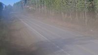
Hilliers › Norden: Highway 4 at Alberni Highway (Highway 4A) junction, about 2 km west of Coombs, looking north
Invermere › Süden
Mono › Norden: Highway 10 near Regional Road 10, Looking North
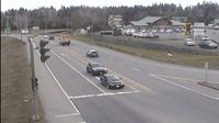
Kent › Osten: Highway 7 at Highway 9 (Evergreen Drive) in Agassiz, looking east

Regional Fraser-Fort George › Osten: Highway 16 at Dunster Station Road, about 30 km east of McBride, looking east

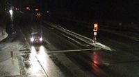
Northern Rockies Regional Municipality › Südwesten: true
Webcam Angebote windy.com.